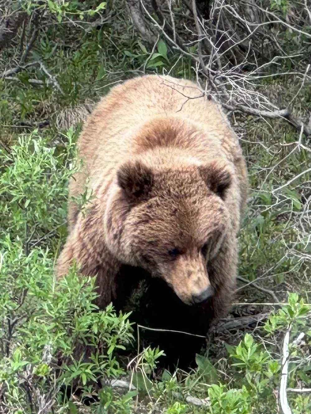
We were driving in Denali National Park and spotted this grizzly right next to the road.
Who Can Sleep?
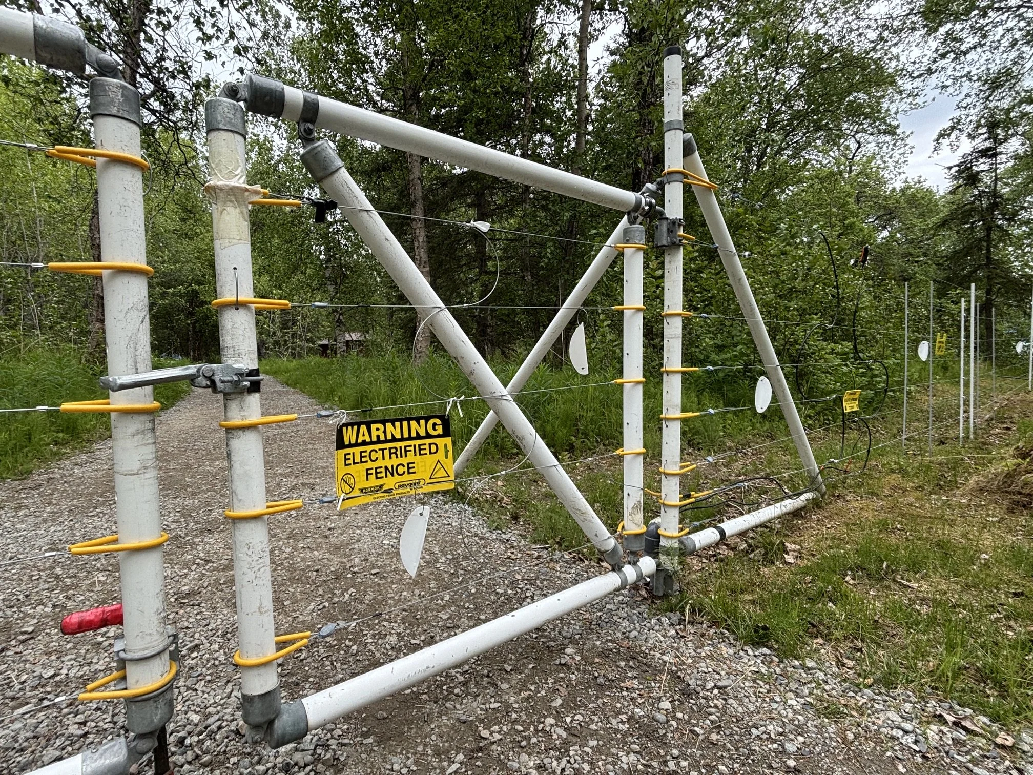
The electrified perimeter fence for the camping area at Katmai National Park. Got to keep out the grizzlies somehow.
Who Wants to Come Inside?
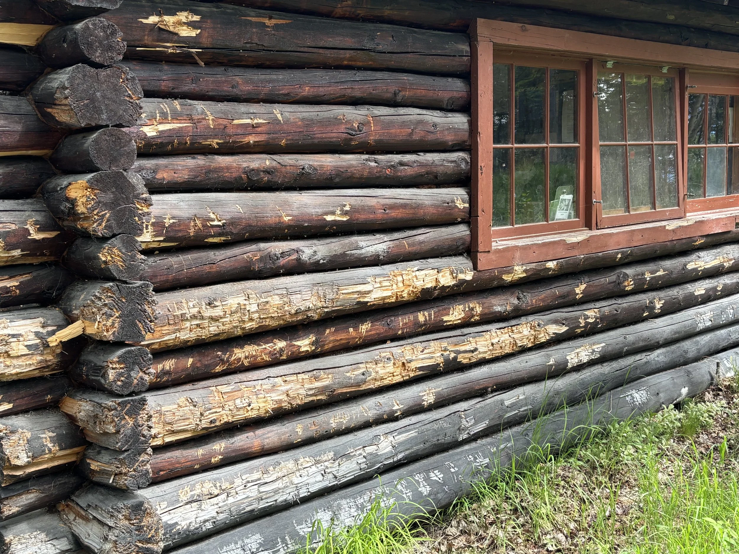
Grizzly claw marks on the ranger station at Katmai National Park.
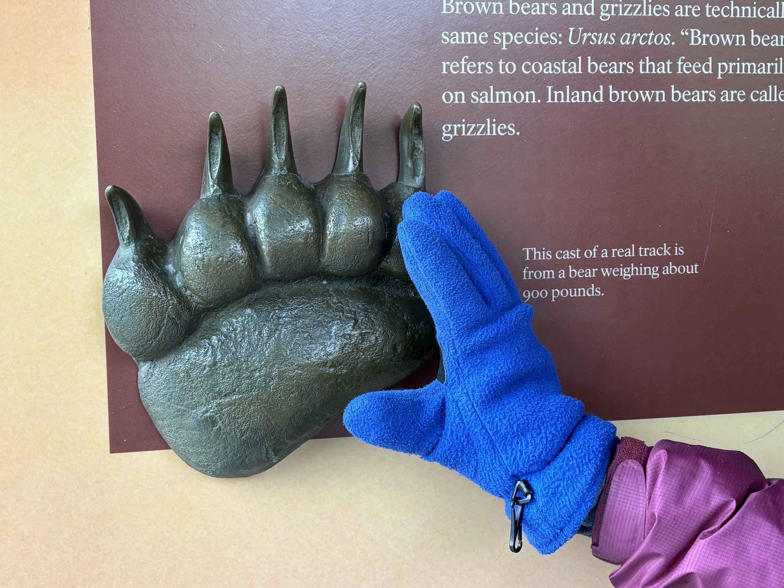
A Little Big
The cast of an actual bear print at Katmai National Park. Instills a certain sense of caution.
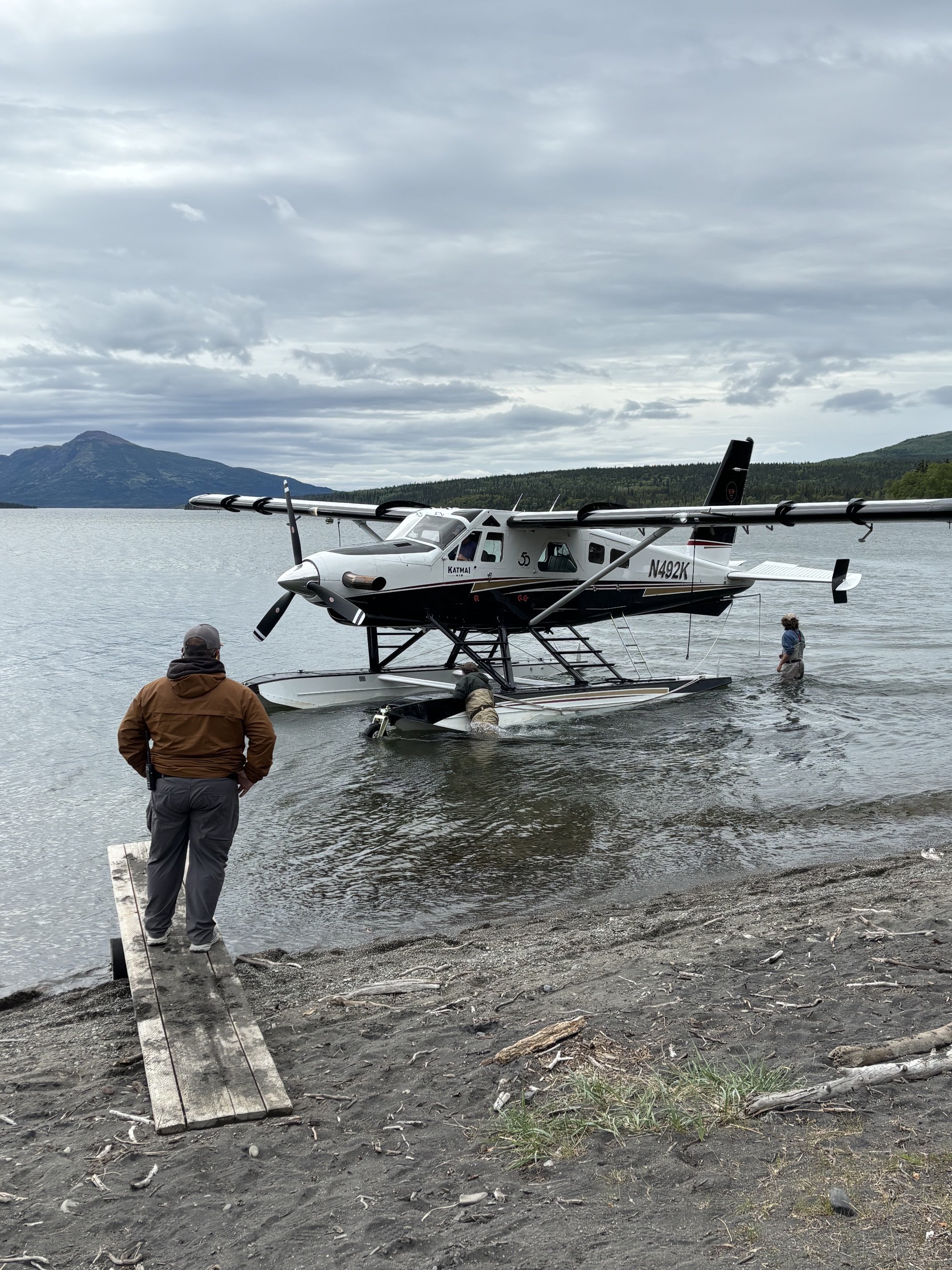
Katmai Gate Number Two
This is the jetway area at Gate Number Two for Katmai National Park. Notice the two gate attendants in hip waders, as well as the uniformed attendant standing on top of the (highly movable) passenger boarding bridge.
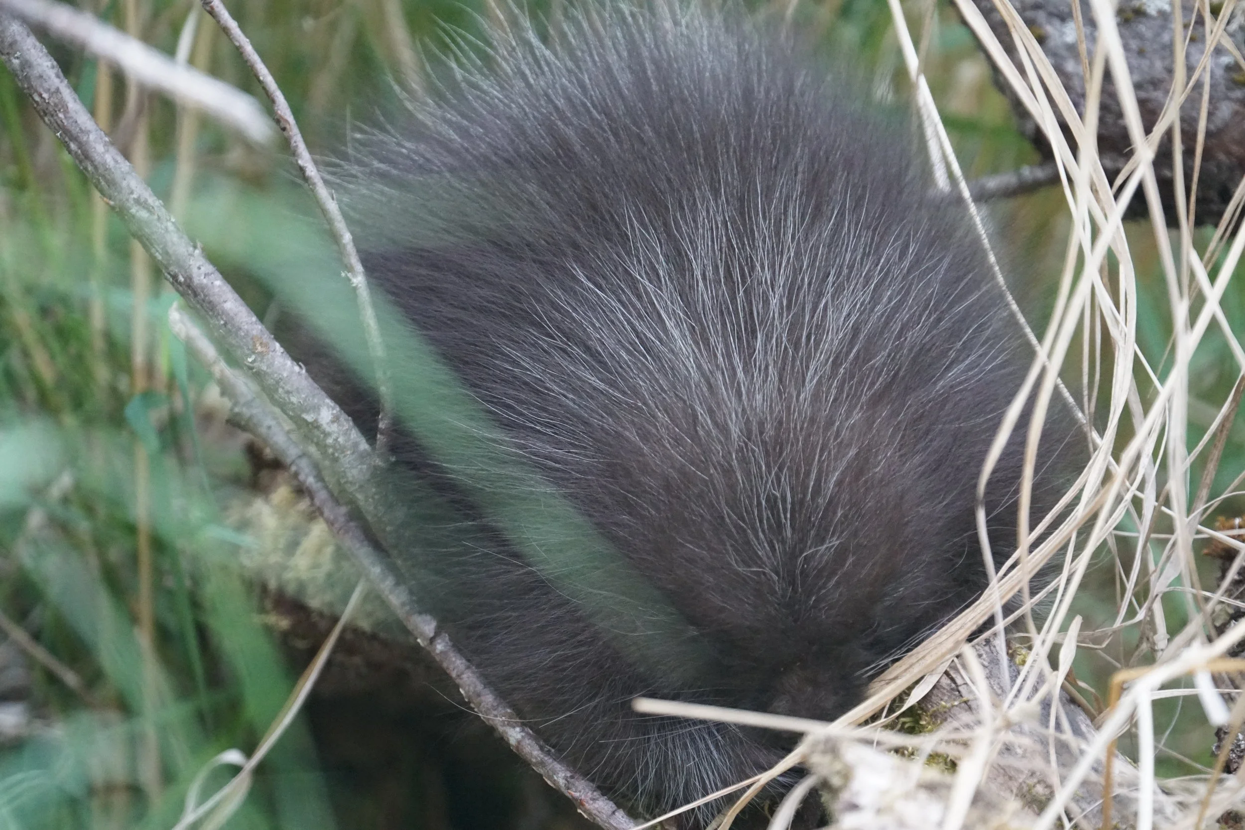
Do Not Pet the Wildlife
A baby porcupine, maybe eight inches across. This little "fuzz"ball was in a bush next to the Katmai National Park Visitor Center.
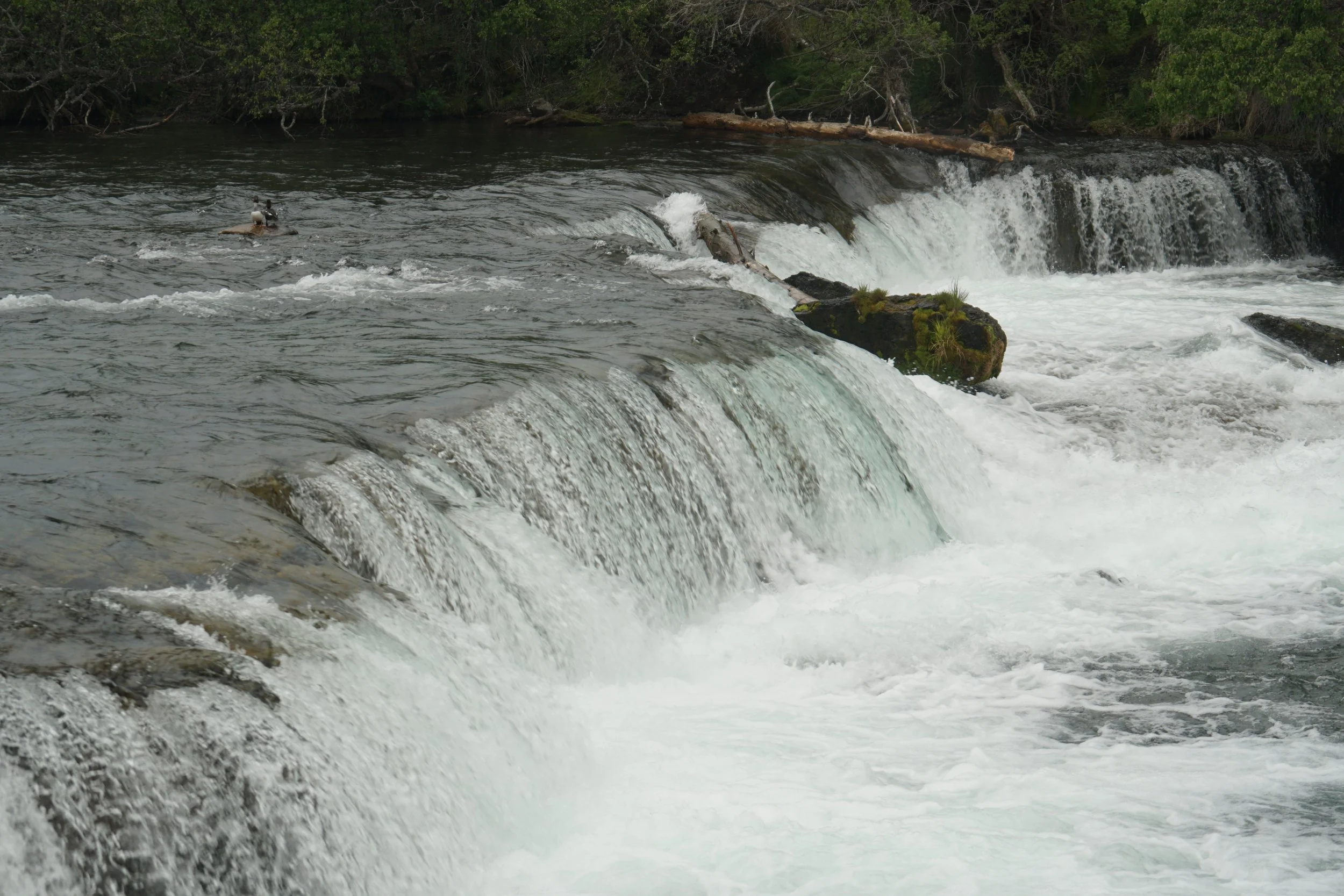
Hope You Like Ducks
Just returned from Katmai National Park in Alaska (not easy to get to), for the annual salmon run and glorious photos of grizzlies eating them. Here are the famous falls. As you can see, no bears, no salmon. Just two ducks in the upper left corner. This is what you get for arriving one week early.
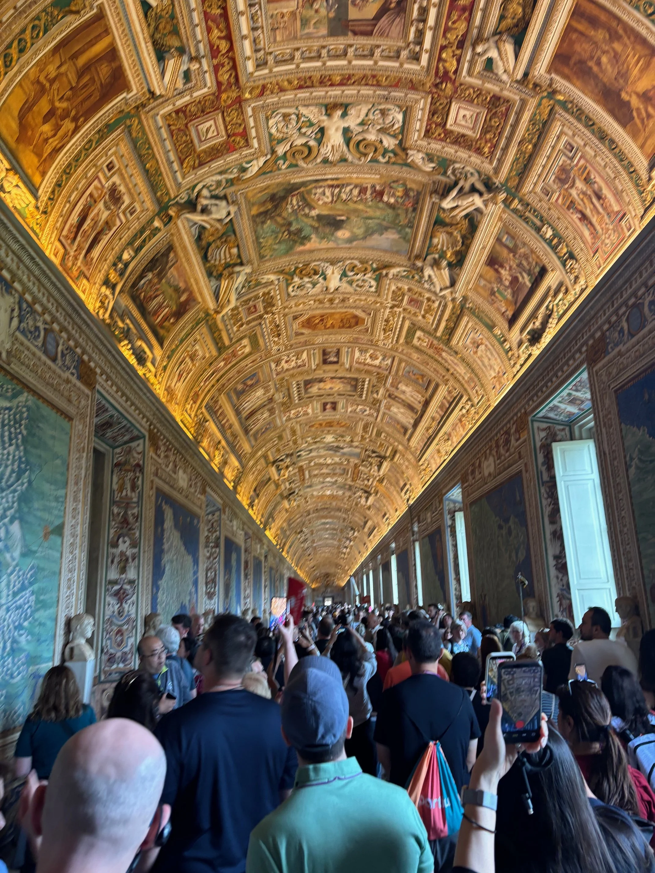
Expensive Maps
The Hall of Maps in the Vatican Museum. Yes it's gorgeous, but look at the crowd!
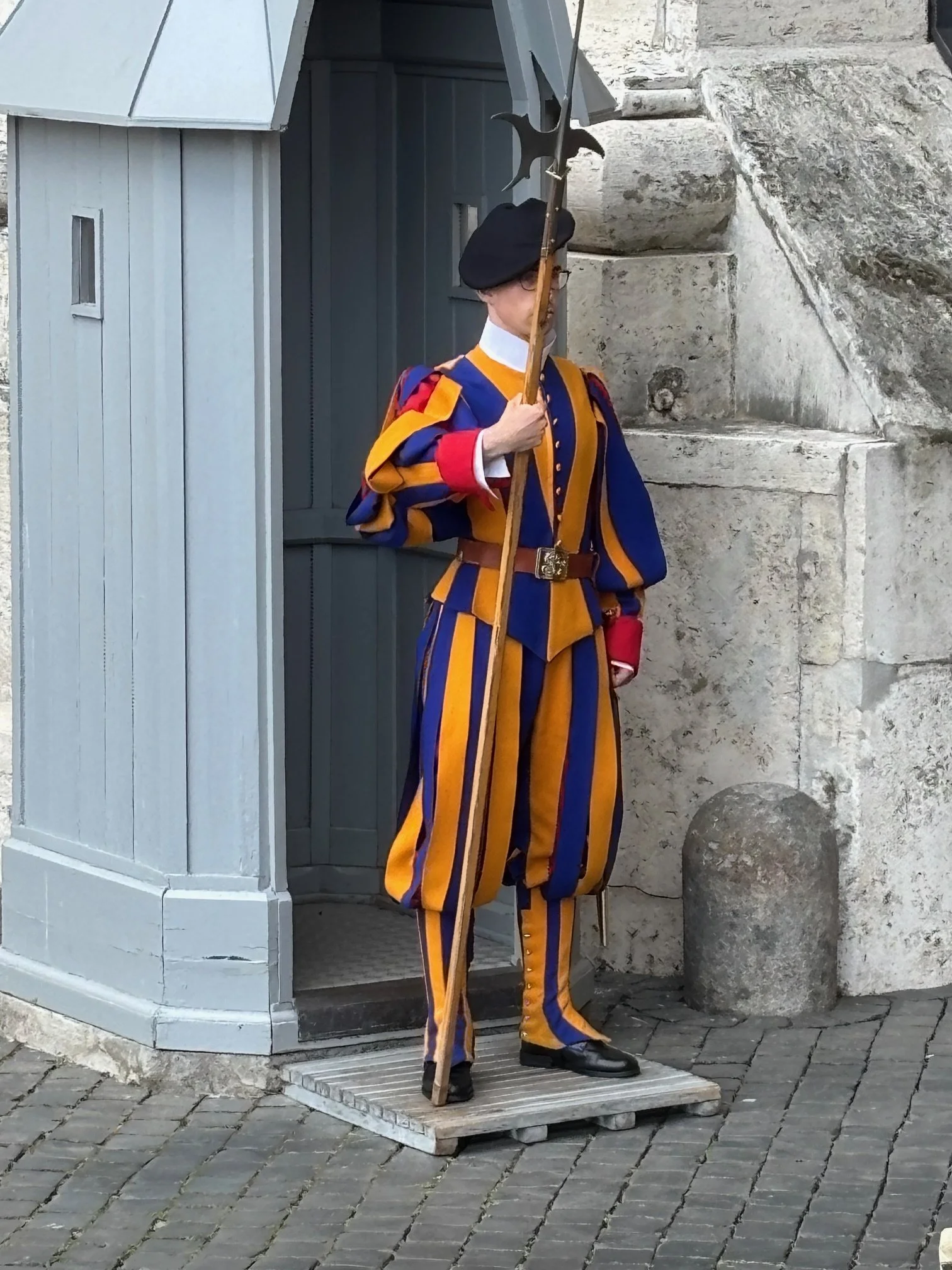
Odd Clothes
Swiss guard at the Vatican. I'm not sure if Ralph Lauren would have designed it this way.
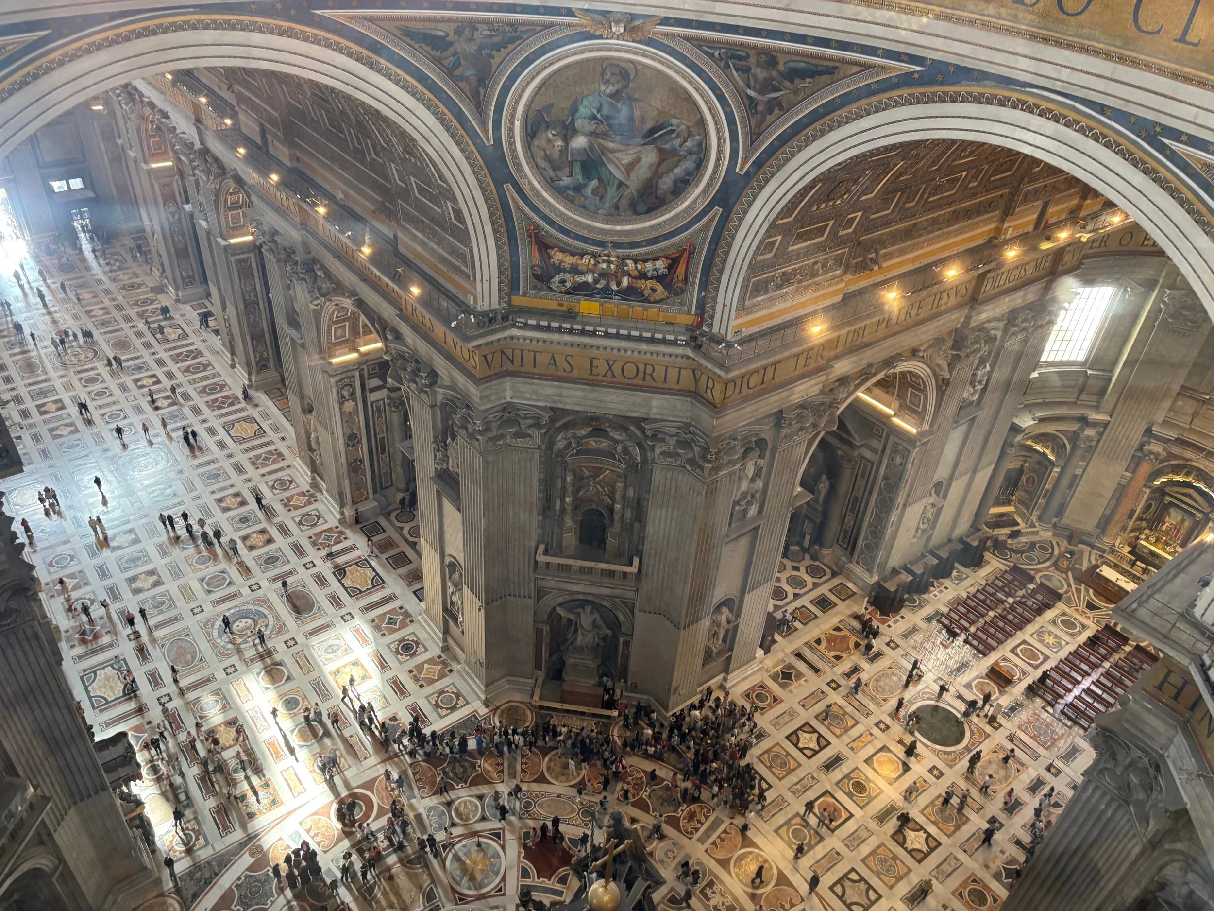
Home of the Pope
St. Peter's is unbelievably massively. Strangely enough, and not to be irreligious, but when you look down on it from the dome at this angle, it looks a bit like a very high-end shopping mall.
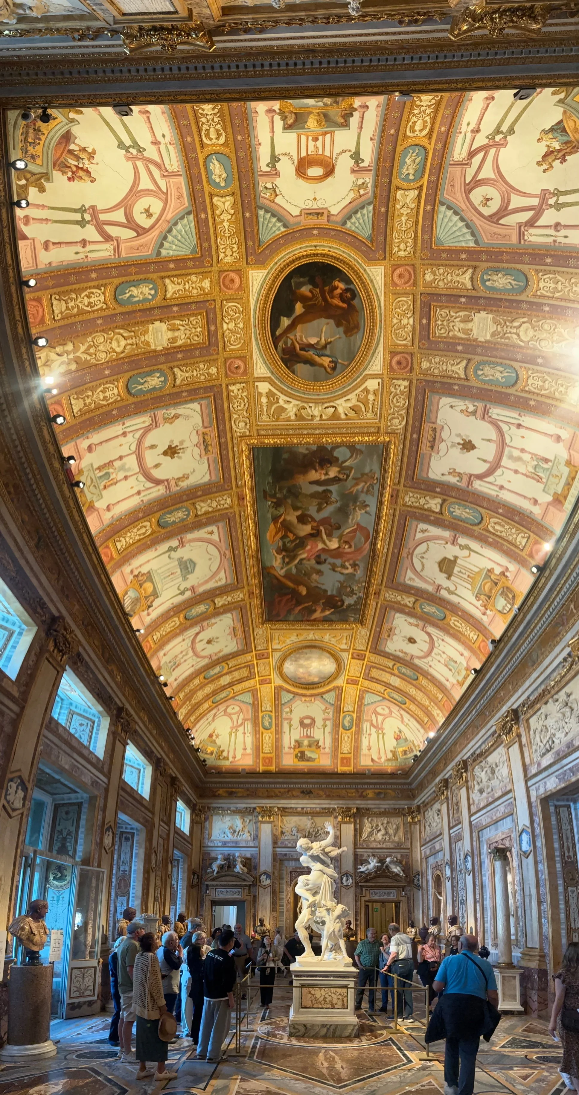
Awesome Ceiling Art
One of the many incredible ceilings at the Borghese Gallery in Rome. So, what do they do if the ceiling leaks?
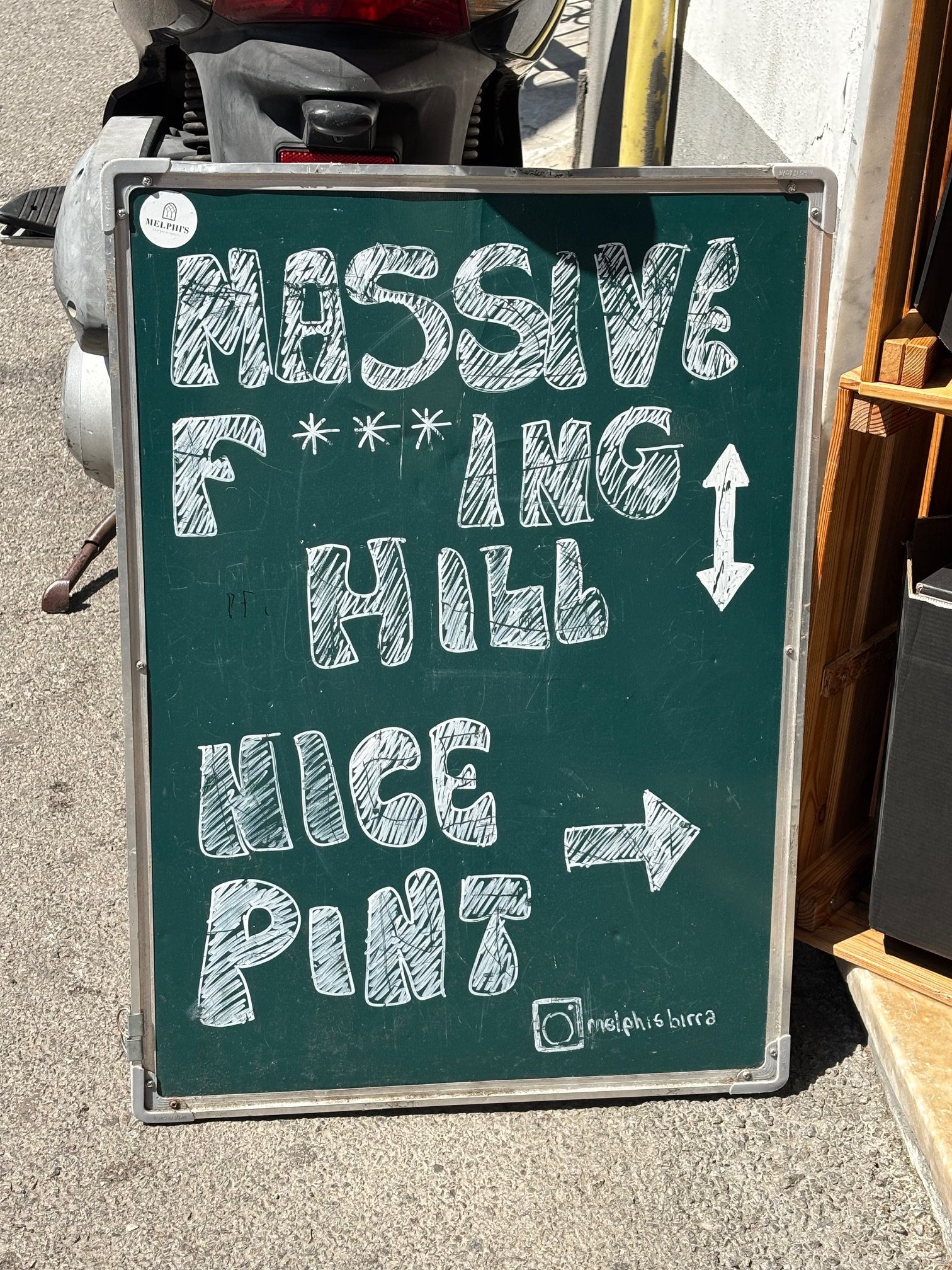
Good Hiking Alternative
A good alternative to hiking up the stairs on the Amalfi Coast.
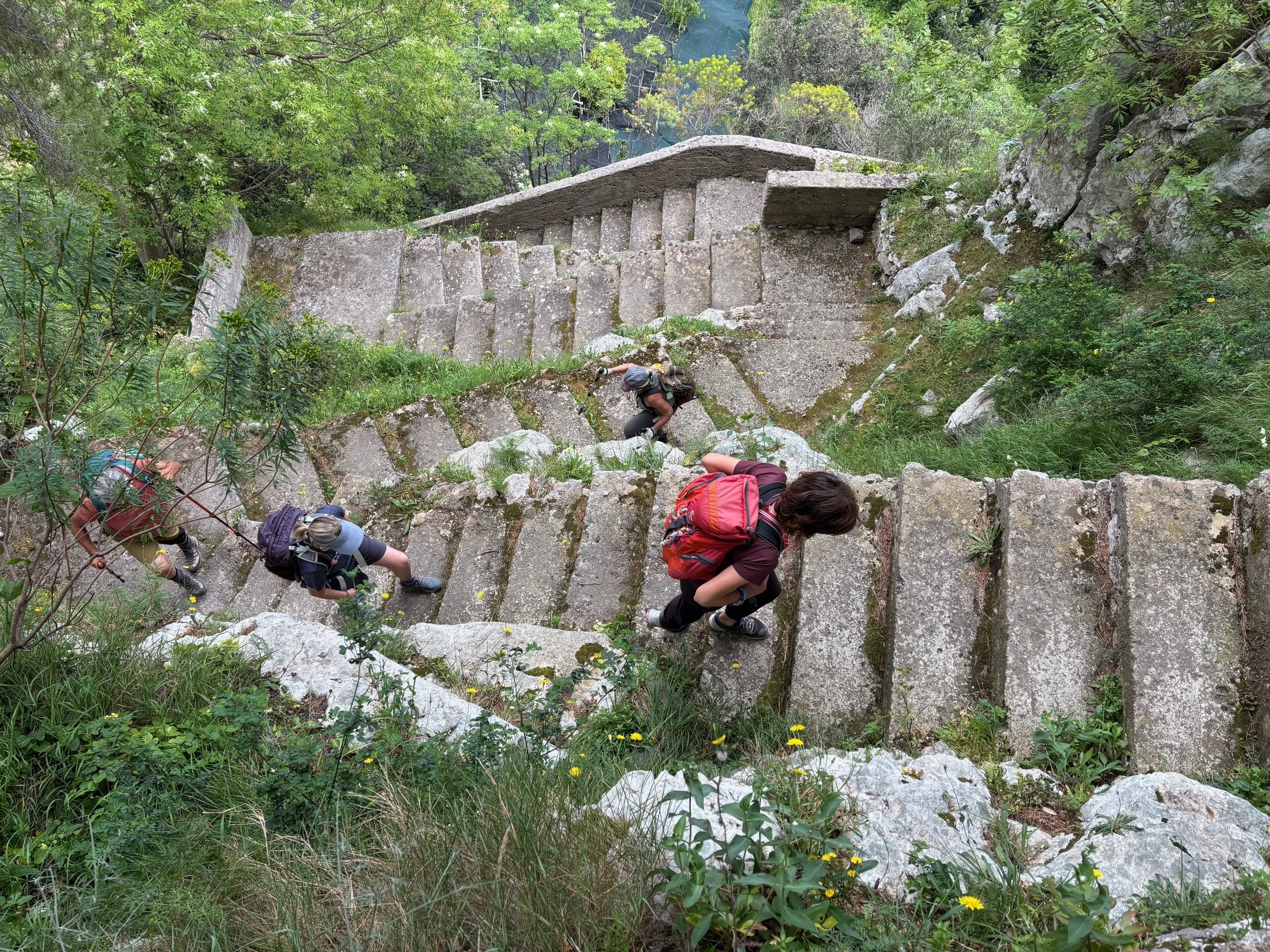
A Walk in the Park
Hiking from one village to the next on the Amalfi Coast involves going up a ridge and down a ridge - and up a ridge, and down a ridge. In short, there are thousands of steps.
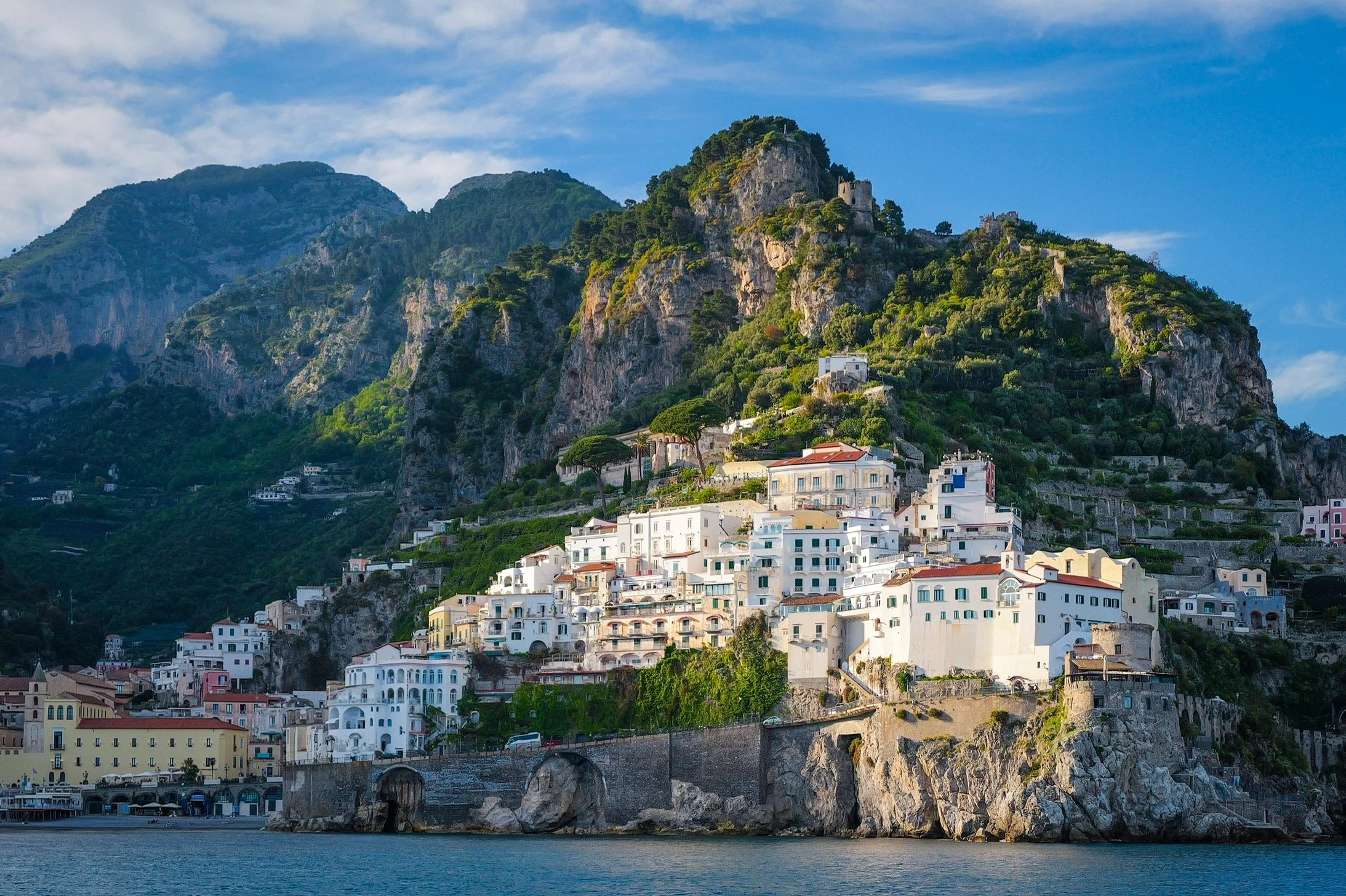
Awesome View
The Amalfi coast looks best when seen from one of the ferries that move you from town to town. That way, you can't see all the tourists (!).
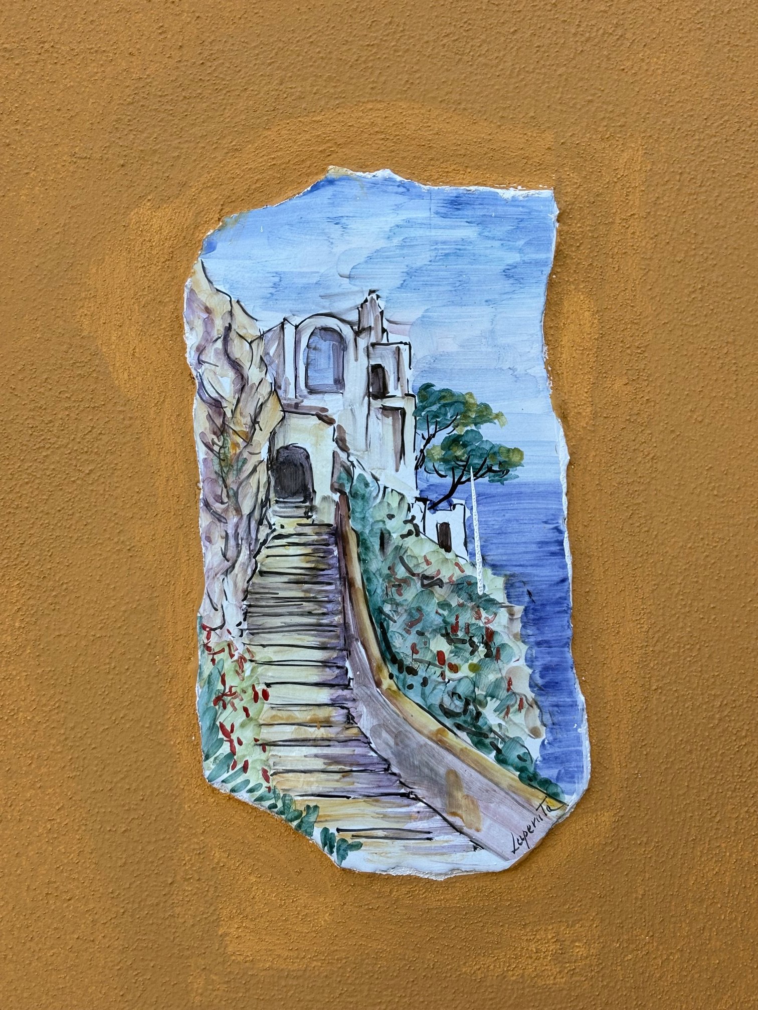
Wall Art
Many homeowners on Capri commission local artists to create these baked-clay images of their homes (or whatever - one had a picture of Napoleon), and then incorporate them into their walls for anyone to see.
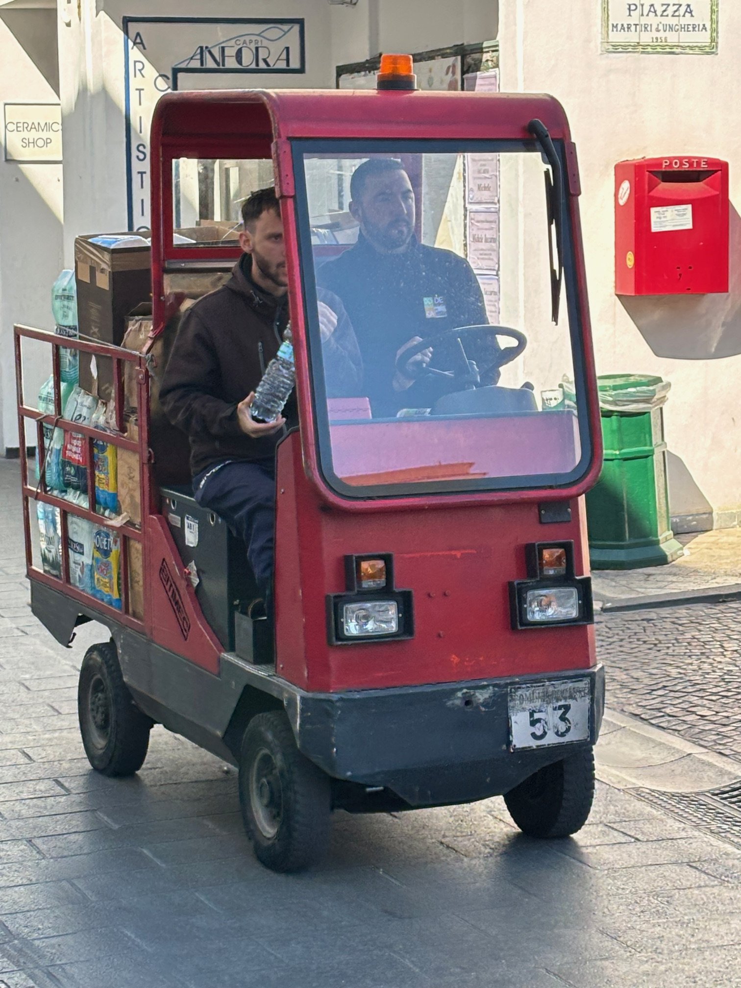
Smallest Transit Van in the World
Outside of the port area, no cars are allowed on the island of Capri, Italy - only these little critters. As you can see from the license plate, they don't have too many of them.
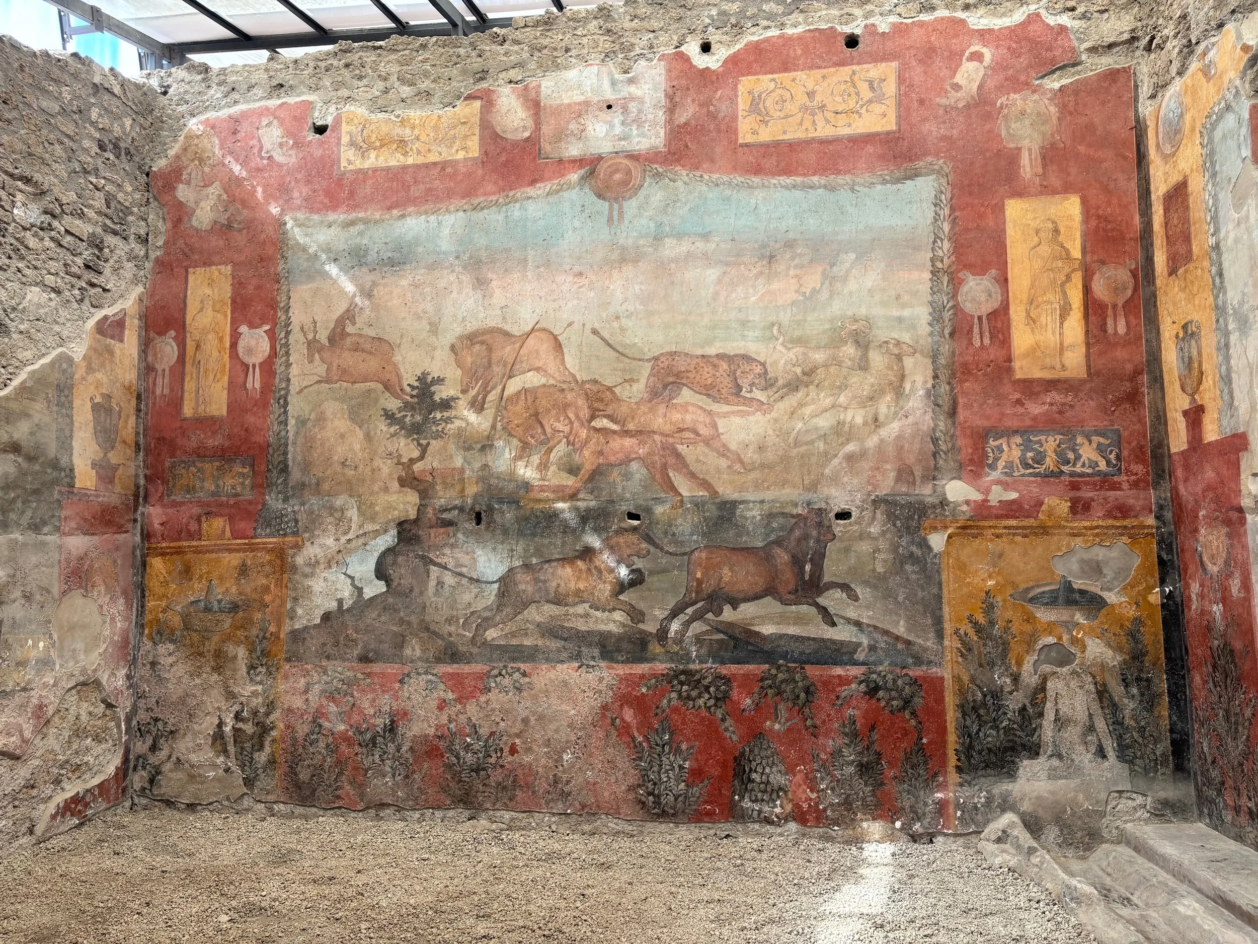
Durable Art
Paint your wall, wait 2,000 years, and see if it looks this good. Okay, it was buried for a while by volcanic ash, but still...
Pompeii wall mural.
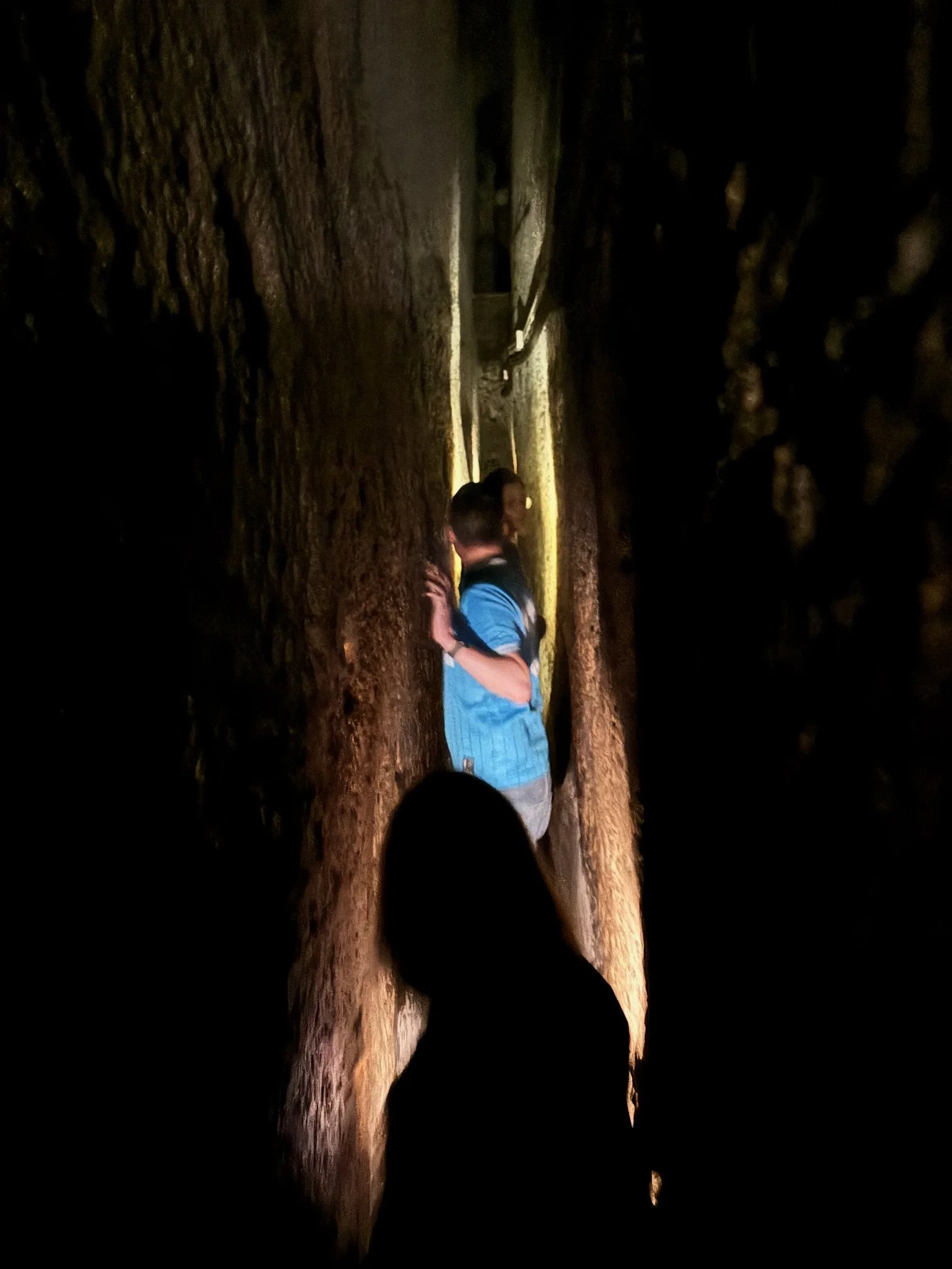
A Tight Squeeze
Shuffling through the aqueducts below Naples, Italy.
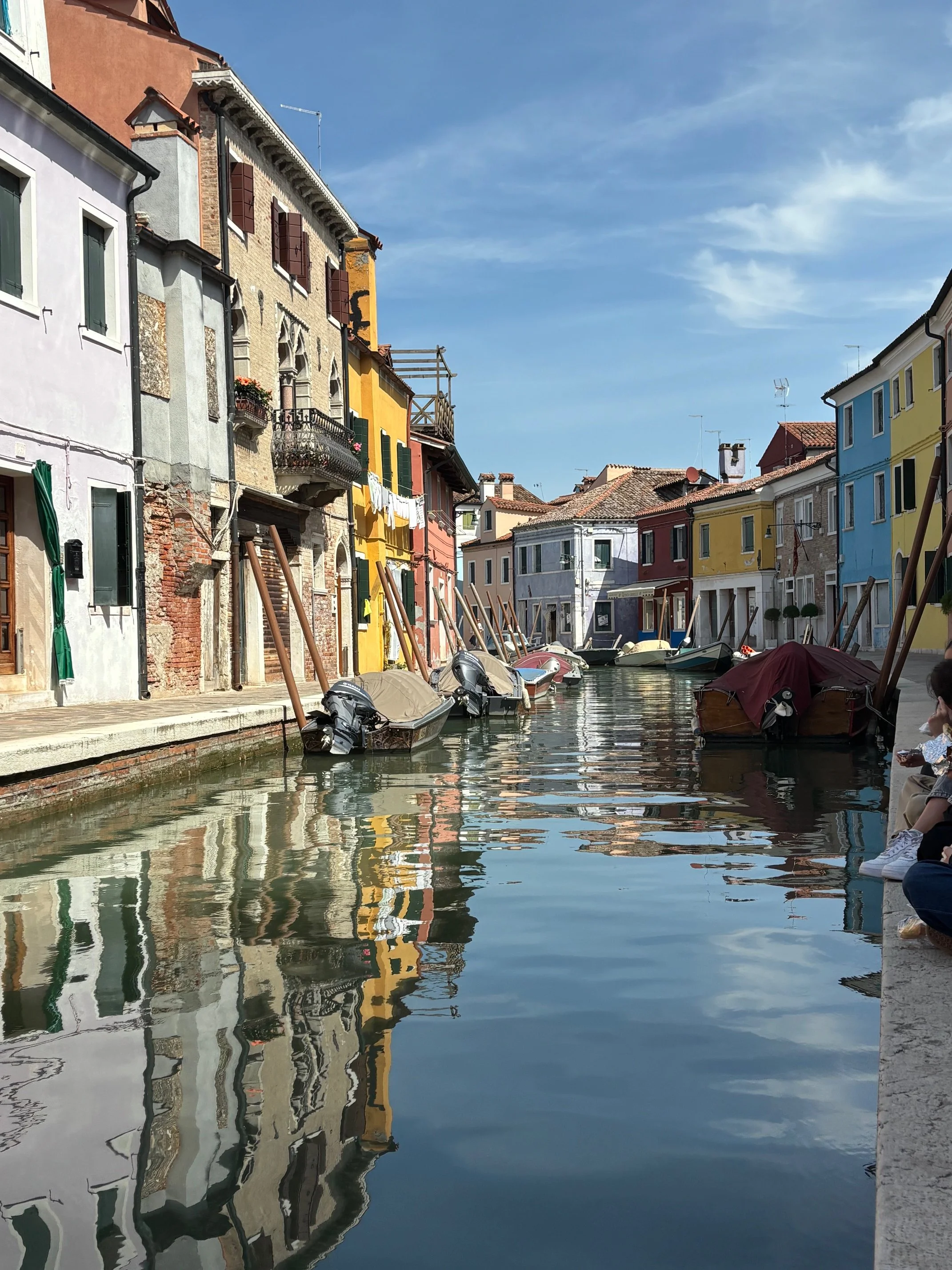
Great Reflections
Great reflections in the canal water of Burano, Italy.
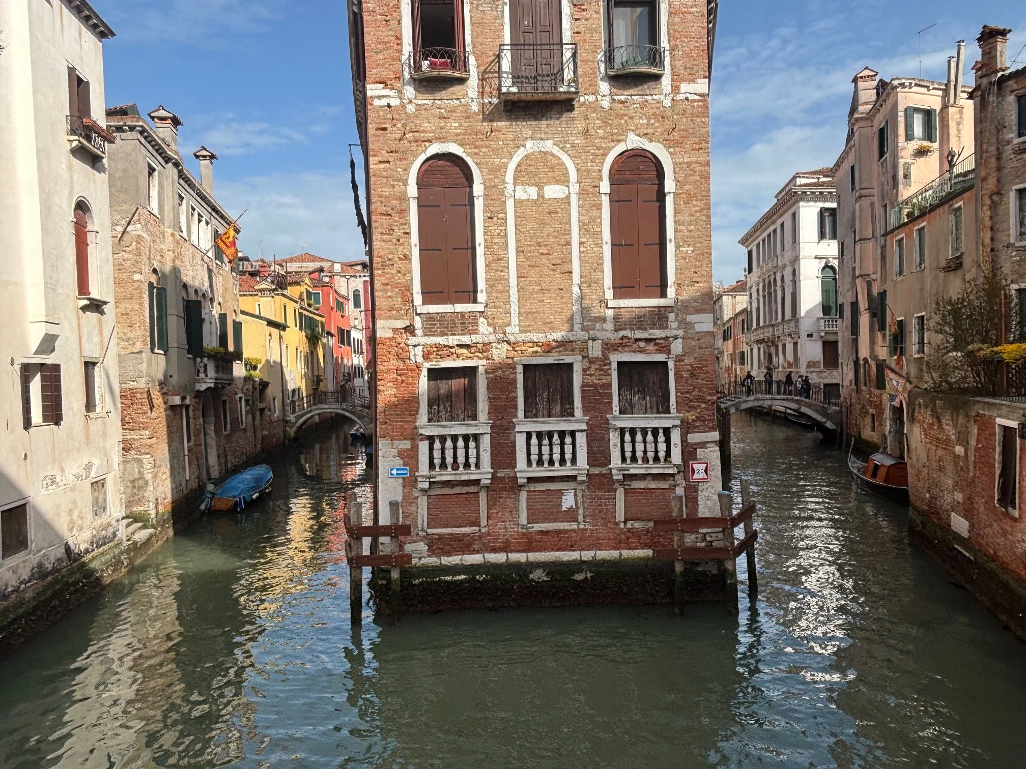
Too Much Water
Imagine having a canal on BOTH sides of your house? Can't image what the basement looks like - if there is one.